Now Google Earth users can see Athens, Greece in 3D. To view make sure the “3D Buildings” layer is checked in the Layers panel.
VIsit http://earth.google.com to download Google Earth.
Now Google Earth users can see Athens, Greece in 3D. To view make sure the “3D Buildings” layer is checked in the Layers panel.
VIsit http://earth.google.com to download Google Earth.
The Google Lat Long blog announced today the launch of their partner DigitalGlobe’s WorldView-2 (WV2) satellite.
DigitalGlobe’s successful launch of WV2 from Vandenberg Air Force Base in California is another important step forward in Google’s making more high resolution, accurate, current imagery available to through its Google Earth and Google Maps products.
If using rockets and satellites to do get a job done aren’t considered a competitive advantage – I don’t know what is.
Is not space the final frontier in the race to map the Earth?
The Google Earth and Maps team have created a new base map dataset that allows Google Maps users to “report a problem” among other new features.
From the Google Lat Long Blog:
“We’ve added a new tool to Google Maps that lets you communicate directly with Google about any updates that you think need to be made to our maps. You’ll find this “Report a Problem” link on the bottom right of Google Maps (you can also find it by right-clicking on the map). Has that new highway on-ramp finally opened up? Do we have an outdated name for your local school? Was Main Street converted into a pedestrian-only walkway? Tell us! Once we’ve received your edit or suggestion we’ll confirm it with other users, data sources, or imagery. We hope to resolve each edit within a month. If you submit your email address, we’ll even keep you posted on our progress.
Just yesterday, I had a problem generating driving directions with Google Maps where a local athletic park had the correct address but an incorrect Zip Code.
Even though Google Maps had the correct street address, the incorrect Zip Code overrode Google Maps ability to generate a correct point A to point B driving route.
In the example below, you can see the business (Mitch Park) address shows a ZIp Code of 73034.

Correct Address Incorrect Zip Code
Since I didn’t know beforehand this was the incorrect Zip Code for the park, when I attempted to generate driving directions yesterday Google Maps “assumed” my directions were to 1501 East Covell because a East Covell street address coincided with the Zip Code data (and still does) they had for the park.

Mitch Park 73034
Today after editing the listing’ push pin to display the correct address on West Covell, Google Maps has begun to offer two alternative destinations and routes – one to the East Covell (73034 incorrect Zip Code) location and one to the West Covell address ( the 73003 corrected push pin location).

Mitch Park 73003
Selecting the corrected Zip Code address link on West Covell then produced correct driving instructions to the corrected Park location.

Correct Google Maps Driving Directions
Overall, the speed with which these corrections took place in both correcting the park’s location vis-a-vis its Zip Code and then the subsequent alternative destination driving directions – were quite impressive.
Combined with their new base map dataset and users ability to report problems, the Google Earth and Maps team should be able to deliver a more accurate and up to date Google Maps user experience.
Google partner GeoEye has provided updated satellite imagery of Tehran, taken on Thursday the 18th at approximatly 11:18am PST.
You can learn more about the new images of Tehran from the Google Earth blog.
The following is a screenshot of the updated imagery.

Tehran Google Earth
Technical information about the new satellite images of Tehran from Google:
The images were taken from GeoEye’s IKONOS satellite, which images at roughly 1-meter per pixel. We are continuing to work with GeoEye to see if we can provide a higher resolution update from the GeoEye-1 satellite, which would be at 0.5-meters per pixel, but this is subject to weather constraints.
David Pogue with The New York Times recently created a list of innovations Google has produced or bought in its relatively short corporate history.
His list consists of Google products most any consumer who has been online in the last year would recognize including Google Earth, Gmail, YouTube and Blogger.
Some of the lesser known Google products and tools mentioned in Pogue’s New York Times article are: Google Docs, Picassa, iGoogle, Google Reader, Google Trends, Google Maps, Street View, Translator, 1-800-Goog411, Google SMS, Google Alerts and Google Sets.
Although the article begins by mentioning Google’s search box, Pogue doesn’t mention the greatest commercial result to come from Google’s search box by name: Google Adwords – arguably without which – none of Google’s other products would exist.
Maybe therein lies the keys to Google’s success.
The Google Earth and Maps team has posted a video tutorial on YouTube for business owners looking to verify or append their business listing data in Google Maps.
From the Google Lat Long Blog:
Local Business Center allows business owners to edit the content of their existing listing, or to add a brand new listing to Google’s local database. By ensuring that basic information is up-to-date and providing additional details, like photos, hours, and coupons, business owners can stand out on the map to attract more customers.
Update your Google Maps listing in Google’s Local Business Center.

Google Local Business Center
Searching for Santa?
Search no further than Google Earth this Christmas.
Google Earth Santa Tracker
In anticipation of the 2008 Christmas Santa searching and tracking season, The Google Lat Long blog reviews Google’s history with NoradSanta.org and the evolution of Santa Search over the last several years.
NORAD – an acronym for North American Aerospace Defense Command – is a joint organization of two countries in North America – the United States and Canada that provides aerospace warning, air sovereignty and defense for North America except Mexico.
I am sure when it was founded in 1958, NORAD’s founders probably did not envision the day would come when the world would be filled with billions of interconnected computers and mobile phones whose owners could each track Santa’s location from the comfort of their home or car with a digital 3D map product called Google Earth… yet indeed today we can.
With Google providing the equivalent of a Santa Radar and a Santa Cam via desktop computers and mobile phones combined with Santa sighting commentary offered in six languages (German, French, Italian, Spanish, Chinese and Japanese) children and adults worldwide should be able to get all of their “Where is Santa?” questions answered on Christmas Eve December 24, 2008 unlike at any other time in history.
The teams from Google Earth and Maps have assembled images and resources for Galveston Texas residents displaced by Hurricane Ike as well as state and local emergency management personnel.
Within hours after Hurricane Ike’s arrival the National Oceanic and Atmospheric Administration’s Remote Sensing Division began flying rapid response aerial reconnaissance missions of the Texas and Louisiana Gulf region.

NOAA Remote Sensing
The NOAA Remote Sensing team has published the data they have collected on their official Hurricane Ike response page.

Hurricane Ike
The images posted on NOAA site are of the coast of Texas and Louisiana after Hurricane Ike made landfall.
The NOAA Remote Sensing Division gathered their Hurricane Ike images to meet NOAA national security and emergency response requirements.
The NOAA data will also be used for ongoing research efforts to test and further develop standards for airborne digital imagery.
To see pictures of Galveston and the Texas coastline in the aftermath of Hurricane Ike, click on the NOAA base map grid boxes.

Hurricane Ike Image
You can then drill down to each NOAA picture taken after Hurricane Ike made landfall.

Hurricane Ike Damage
The Google Earth and Google Maps teams have also processed the National Oceanic and Atmospheric Administration data it into a KML image overlay for easy access.
Here is just one example of the type of before and after pictures you can view of Galveston, Texas after Hurricane Ike struck the Texas Gulf Coast.

Hurricane Ike Before Picture
Hurricane Ike Before Picture

Hurricane Ike After Picture
Hurricane Ike After Picture
Search for the Earth Day word that isn’t really one from the following list of 21 iGoogle tab themes.
Google offers custom Google page themes for iGoogle account holders.
After you have established your iGoogle account, you will see your home page tab followed by “Add a tab” and then to the far right “Select theme” and “Add stuff” links.

Click on the “Select theme” link and you will be taken to directory of Google themes for use as images within your iGoogle tabs. You can search for word specific themes or drill down through their list a page at a time.

I have searched through the majority of iGoogle page theme options to produce the following selection of 21 Earth Day related images and words for use in your iGoogle tabs.
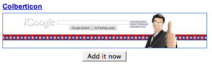
To keep things interesting, I have slipped in one image and word that under most circumstances wouldn’t qualify as an Earth Day related term.
See if you can figure out which one word and image aren’t even remotely related to Earth Day and submit your answer in the “Leave a reply” section of the post.
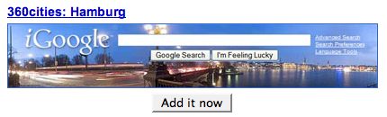
Hamburg
Moscow

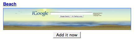
Beach
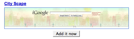
City Scape
Cutler Maine

Digby Sunset

Earth Light

Fenway Panaorama

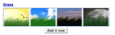
Grass
Hong Kong

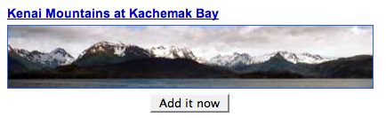
Kenai Mountains
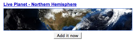
Live Planet Northern Hemisphere
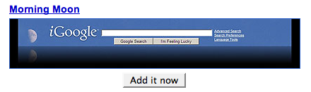
Morning Moon
Mountain

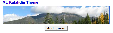
Mt. Katahdin
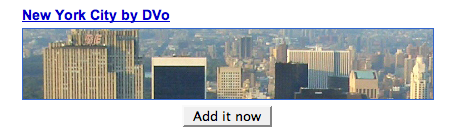
New York City
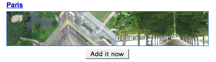
Paris
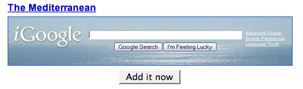
The Mediterranean
Stephen Colbert | Stephen Colberticon
Theme 1

Tibet Himalaya Mountain


You must be logged in to post a comment.