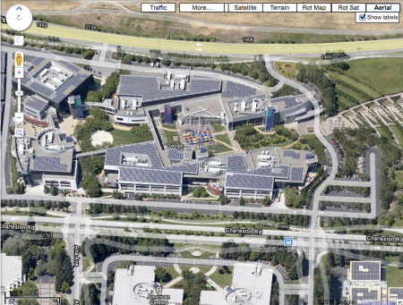
Google Maps has added several new Labs features like Aerial Imagery.
Although Aerial Imagery isn’t yet available for more than a handful of locations, Google implies more aerial imagery may be made available.
From the Google Maps team:
Add Aerial imagery to the map! Aerial imagery gives you rotatable, high-resolution overhead imagery presented in a new perspective. Currently imagery is only available in certain areas, but we’re adding more all the time.
If you have ever wanted to get a bird’s eye view of the Googleplex in Mountain View, CA, Google Maps aerial imagery now provides it.
Zooming in provides the following view:
Google’s aerial image quality now appears to be on par with Bing’s Bird’s eye view image quality.
However, Google’s aerial image viewer appears to let map users zoom in twice as close to a location as Bing’s Bird’s eye view.
Anyone know where Google is getting these new images?
If they are getting these images by airplane, won’t it take untold man hours to flesh out their image database?


You must be logged in to post a comment.